Google Classroom
GeoGebraGeoGebra Classroom

Introduction to Cartesian Coordinate System

WHO INVENTED WHO?
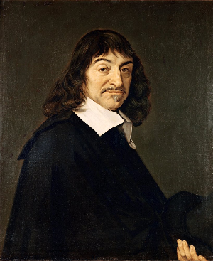
WHO INVENTED WHO?
The coordinate system we commonly use is called the Cartesian system, after the French mathematician René Descartes (1596-1650), who developed it in the 17th century. Legend has it that Descartes, who liked to stay in bed until late, was watching a fly on the ceiling from his bed. He wondered how to best describe the fly's location and decided that one of the corners of the ceiling could be used as a reference point. Imagine the ceiling as a rectangle drawn on a piece of paper: taking the left bottom corner as the reference point, you can specify the location of the fly by measuring how far you need to go in the horizontal direction and how far you need to go in the vertical direction to get to it. These two number are the fly's coordinates. Every pair of coordinates specifies a unique point on the ceiling and every point on the ceiling comes with a unique pair of coordinates. It's possible to extend this idea, allowing the axes (the two sides of the room) to become infinitely long in both directions, and using negative numbers to label the bottom part of the vertical axis and the left part of the horizontal axis. That way you can specify all points on an infinite plane.

THE COORDINATE PLANE

TEST Yourself!

Use the x-value and y-value sliders to graph the blue point. 1. If x is negative, it is to the _______________ of the y axis. 2. If x is positive, it is to the _______________ of the y axis. 3. If y is negative, it is to the _______________ of the x axis. 4. If y is positive, it is to the _______________ of the x axis. 5. Fill in the blanks with a positive and negative. See the example. a. If a point is in Quadrant I, its coordinates are (+, +) b. If a point is in Quadrant I, its coordinates are (+, -) c. If a point is in Quadrant I, its coordinates are (-, +) d. If a point is in Quadrant I, its coordinates are (-, -) 5. Switch to practice mode and see how fast you can graph all of the indicated points. It may help to reset to the origin each time and figure our the coordinates of the targets first.